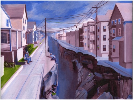
While touring Kevin Babola's art studio yesterday, I found this thought-provoking piece entitled ‘Political Landscapes.’ I greatly enjoyed my conversation with the artist about the political, economic and urban visions that went into this painting. The conceptual idea behind this painting started when the artist was exploring the neighborhoods of New Bedford, MA and noticed how a sense of place can change very quickly. I dare say most cities have areas similar to the one portrayed here where the socioeconomic character changes very abruptly. While physically it might be very easy to cross from the side of the street with tenements to the neighborhood with single family homes, making that transition permanent is incredibly difficult.
Questions to ponder: what leads to cities having abrupt changes in the urban fabric? What might this chasm represent to people on either side of the divide? How does this impact the neighborhood institutions (schools, local government, etc.)? Please visit the artist's webpage at: http://www.kbolaillustration.com


 Your new post is loading...


I enjoyed this exercise, it was fun and creative.
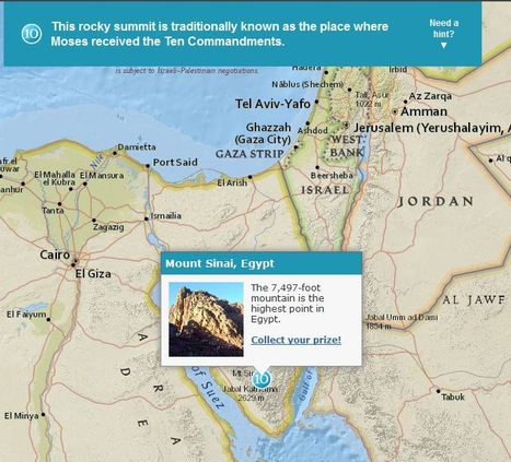
This is a brand new and to me, a unique way of exploring global geography by using trivia questions as a means to explore the world.
I love this geography, map-based quiz that let's people explore the world as they learn about some interesting places.